Hail, rain, sleet, a few fleeting snowflakes, wind and sun. Immaculate air. Sheep, stone fences, lines of trees with their naked branches and twigs making fractal patterns against the sky. A great day for a walk in the Peak District.
The three of us climbed, glad to drink fresh air after a week in central heating. We came up over the Liggate, where we could see slight furrows and ridges in some fields, shadows of the medieval farming system. Some of the fields retain their medieval names – Windy Wappins and Breedy Butts, for example. The term ‘butts’ refers to the ridge that was created by the ploughing technique used.
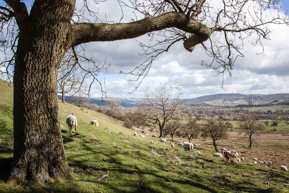
The start of the hike took us through fields of grazing sheep
The Liggate is an ancient corpse road between Edale and Castleton. Before Edale had its own church, people carried their dead to be buried in consecrated ground at Castleton. In the late 1700s it was still in everyday use by the women and children walking to work in Richard Arkwright’s cotton mill in Edale.
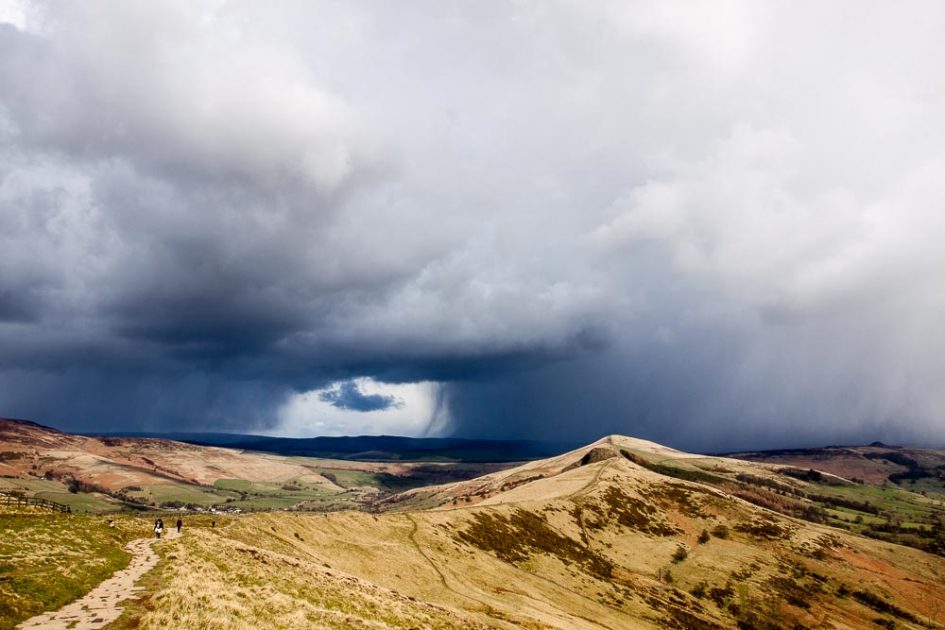
At the top of Mam Tor, feet planted wide against the wind, we took in views of weather passing through, clouds metamorphosing like a time-lapse film clip as they rushed over the still folds and hollows of Edale and Castleton. The tor is the site of a fort built by the Celts 3,000 years ago.
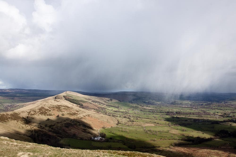
Another shower passes by
We followed the ridge and dipped into Mam Nick. The first hail shower hit as we crossed some fields. It had cleared to sun again by the time we reached the next lane, where we bought fresh eggs at a farm gate. Sheep are used to walkers and ignored us. Between two stone walls running parallel 2 metres apart, emerald moss had colonised the stones and the trunks and lower branches of the trees growing there.
Most of the fields have distinct sunken areas. We were walking on the roof of the limestone caves that are all through this area. Apparently new caves are discovered regularly, and cavers recently found the footprints of miners that were left in the mud when a mine was abandoned hundreds of years ago. Mining for lead and blue john is an ancient occupation here. The area is home to several lead-tolerant plants, such as spring sandwort, mountain pansy and moonwort, which are generally rare, but locally common.

As we passed through farmers’ fields, the sun came out

Nearing the Liggate, and looking back towards Castleton, and basking in sunshine
We circled behind the village of Castleton into Cave Dale as the weather closed in and doused us in turn with tiny hail, sleet, rain, and even a few fleeting snowflakes. The cold sank into us. We descended back to the town down a sharp gully that was running water and slippery, so the going was too slow to keep our body heat up to it. The wreck of the Peveril Castle loomed above us. The castle was built by the Normans in the 11th century. The view through the downpour was beautiful, like lines from a Wordsworth poem.
We didn’t mind the cold too much. Twenty minutes later we were back in Castleton and shouldering open the door of a pub, ordering drinks and beginning to thaw in the heat of the room. Pubs along the way are one of the joys of walking in this part of the world. It seems such a civilised aspect of a walk in England, although part of the reason I enjoy it is its difference to the walking we do in Australia, where we prefer to go off-track and lose sight of human occupation. That sort of walking is impossible here, where the landscape is thoroughly built and moulded. It has it’s compensations, and one of them is villages along the way, and their cafes and pubs. Another is Ordnance Survey maps.
Invigorated enough by the exercise and the beauty of the landscape, fortified by beer (Dave), red wine (Jenni and me) and conversation with Wendy and Alan, we were happy enough to head for home (which for the moment is Nottingham) and plan the next walk.

But we weren’t done with the wet weather … as we neared Peveril Castle the hail came down
Leave a Reply